A great hike that showcases the different habitats Skeikampen has to offer.
Tour description
The trail is about 8 kilometers long and takes about 3 hours to complete. It is suitable for most people, as it is mostly on easy terrain.
The hike starts at Høyfjellstunet. Follow the gravel road up the hill towards Skeikampen and turn left onto Setervegen. After about 200 meters, turn left onto the trail to the northwest. This is part of the orange trail that goes around the mountain.
As the trail begins to rise slightly, the terrain also changes. The shrubs and trees become lower and denser, and you get a good view of several nice peaks. This is a popular hiking area, so you may meet cyclists and riders along the way.
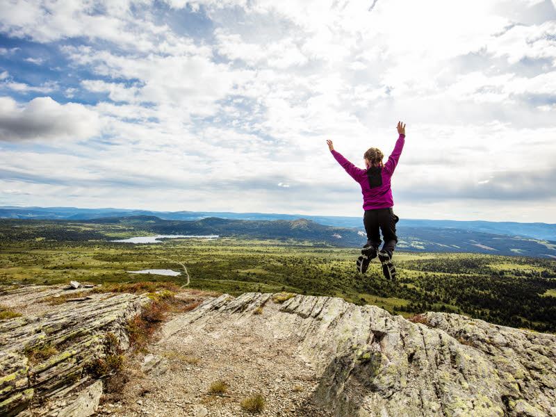
Turn right at the shelter: then the climb begins, not much, but just enough to get you warmed up. When you reach the top, you are at about 1050 meters above sea level, and have a good overview of Skeikampen's two sides. In the north, you have mountains, scrub forest, and snow. In the south, you have forests, pastures, and farmland. Just below you is Torsdalen with its heart-shaped lake.
Follow the trail south, but instead of following the trail to the top, we take the T-marked Peer Gyntstien trail that runs along the side of the mountain. This trail offers stunning views of the surrounding area, including Jotunheimen and Rondane national parks.
The route is marked S5 Skeikampen rundt short.
We hope you enjoy this hike!